Whanganui River Road
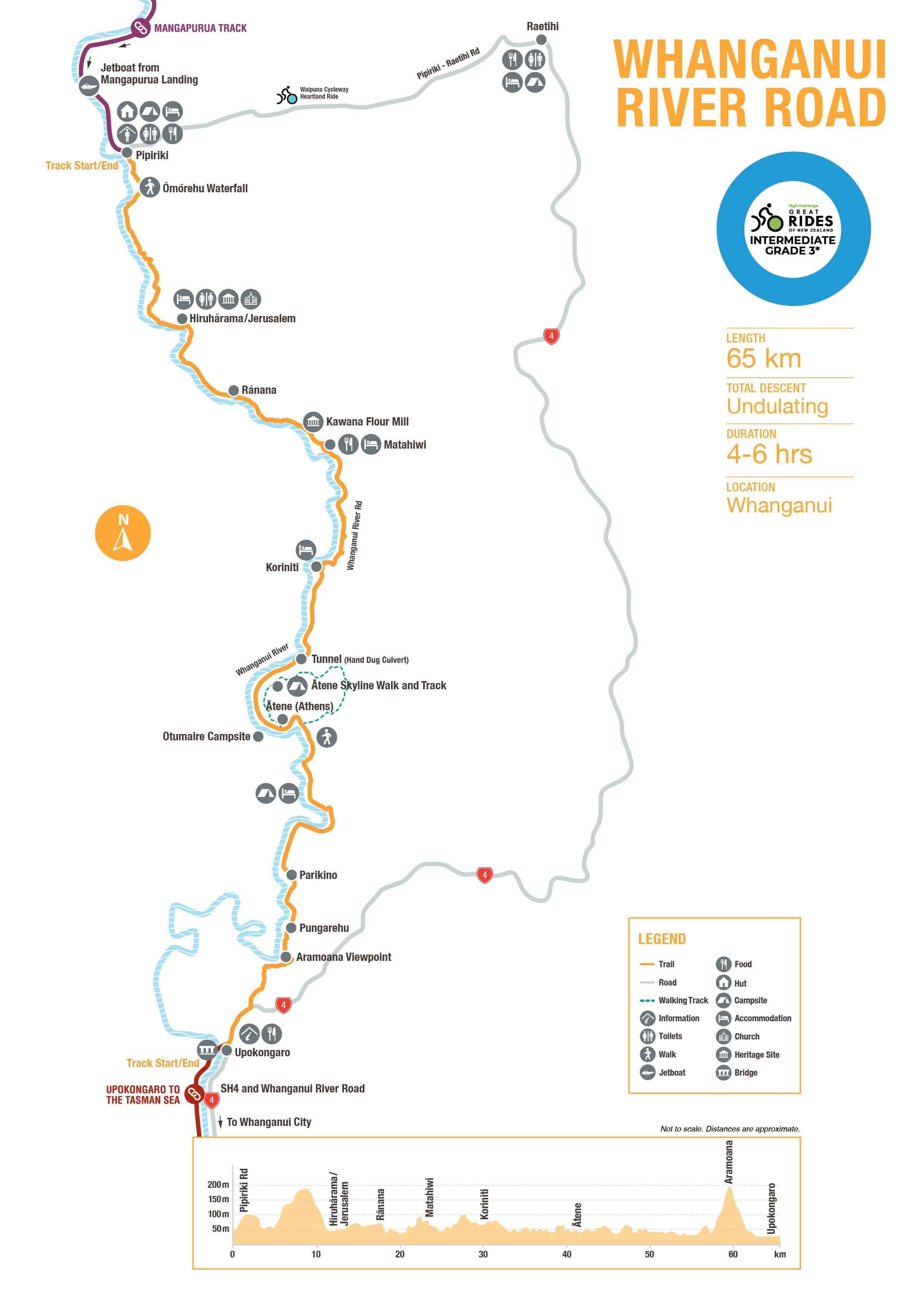
Following the Whanganui river as it flows towards the sea, this peaceful road blends sublime scenery with a series of delightful heritage sites, both Māori and European. Starting at Pīpīriki – gateway to Whanganui National Park – this long but leisurely ride undulates through small settlements perched high above the mighty river.
Beautiful marae, notable church and convent, charming old flour mill, and other special sights tell their stories.
Highlights
- elevated river views
- tangible Maori culture
- notable heritage sites
- easy riding on a country road
- character-filled accommodation
History & Background
The Whanganui River Road is steeped in rich history and cultural significance, reflecting the deep connections between the Whanganui River and its people, particularly the Whanganui iwi. The river was originally a vital transport route for Māori who lived along the riverbanks, with waka (canoes) being the primary means of transportation. In the late 19th and early 20th centuries, European settlers and missionaries used the river to access remote settlements, and the construction of the road itself began in 1934 to facilitate further access to these communities. It meanders through numerous historical marae, pā sites, and settlements, each carrying a unique story of the river’s significance as a lifeblood for both trade and cultural identity.
This historic route also plays an important role connecting cyclists with a journey through time, showcasing the historical and cultural landscapes that have shaped the region. Riders can immerse themselves in the scenic beauty of the river while learning about the historical sites along the way, including remnants of Māori settlements and the efforts of early European settlers. This section of the ride brings together both natural beauty and heritage, allowing riders to reflect on the historical significance of the Whanganui River as they traverse one of New Zealand's most scenic and culturally rich cycling routes.
Trail Route
Although the Whanganui River Road can be ridden in either direction it is most commonly started at Pipiriki by cyclists riding the entire Mountains to Sea Cycle Trail. It can also be ridden as a day trip using local shuttles. This section of the Mountains to Sea ends at Upokongaro village on SH4.
Reasonably fit cyclists can ride the whole road in one day. Accommodation along the way, however, allows the journey to be broken into a more leisurely two days.
While not a technical ride, the fully sealed road is gently undulating and therefore involves a fair bit of climbing – approximately 600 metres over 67km, including a couple of particularly gnarly ascents near the start and finish.


Need to Know
This Grade 3 (intermediate) trail will suit riders of most ability, although a decent level of fitness is required to complete the ride in one day.
The trail follows the fully sealed (tarmac) Whanganui River Road for its entire 64km length, plus a 3km section on State Highway (SH4) between the southern end of the River Road and Ūpokongaro.
Despite following the Whanganui River as it gently meanders downstream, the road is undulating with over 600m of climbing in total. The two ‘best’ climbs are in the first and last 10km of the ride.
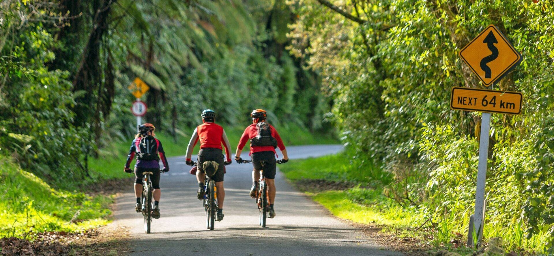
Traffic on the River Road is generally light but it can get busy during the summer months; good road sense is required.
Heavy trucks and cars barrel along the short state highway section so riders should take extra care here. Hi-vis clothing is recommended.
Mountain bikes, hybrids, tourers and even road bikes are suitable (although the road is a bit lump in places). E-bikes are also an option provided they have the capacity to last for the whole day in this hilly environment.
Unless you somehow accidentally head west along Raetihi Rd at the start, it’s pretty much impossible to get lost. Just keep the river on your right-hand side! A map and a copy of the Whanganui River Road Guide, will help you time your ride and appreciate the fascinating stories of this special place.
The road can be ridden all year round, although the best weather is generally between November and April. Heavy rain can occur at any time of year, and if a southerly is blowing it can be a very long day in the saddle. Check in with the locals for the latest weather forecast and road conditions.
The Pīpīriki campground has a tiny shop that sells basic supplies, soft drinks and ice cream, although riders should bring plenty of food. If it open when you pass, the Matahiwi Gallery Cafe is definitely worth a stop even if you consider yourself well stocked. (Who can resist home baking?)
Tap water is available at reasonably regular intervals along the road.
Cellphone reception along the Whanganui River Road is patchy at best, and cannot be replied upon.
Shuttle transport is readily available but must be booked in advance. Many of the operators also offer packages combined with the jet boat ride down the Whanganui from the end of the Mangapurua Track to Pīpīriki. There are operators based in National Park, Ohakune, Raetihi and Whanganui, and a couple of outfits with bases in Pīpīriki.
Shuttle drivers and other local operators will gladly update you on current road conditions or hazards. (or check our trail status page)
There are toilets in Pīpīriki, the convent at Jerusalem, Rānana, Matahiwi Gallery and the Otumaire campsite.
This section connects with the Mangapurua Track (Section 4), and Ūpokongaro to Tasman Sea (Whanganui).


